CCC Laminated Bilingual World Wall Map - 28" (711.20 mm) Width x 40" (1016 mm) Height
Item Code: CCC80011
Category
Maps
Manufacturer Canadian Cartographics Corporation
Manufacturer Ref 80011
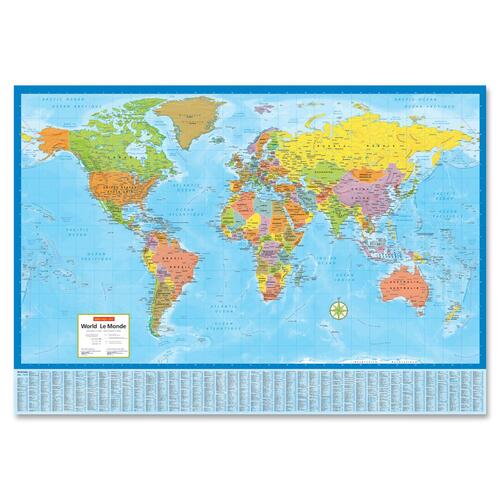
- Full-color image helps easily distinguish various locations
- Laminated design allows use with dry-erase markers to highlight areas
- Index provides easy reference to cities, flags, population and more
- Bilingual format offers easy use for both English and French speakers
Description
Wake up your walls with this colorful, contemporary and detailed laminated political/physical World Wall Map with index of country and city names. Map clearly distinguishes each nation with color tints. Shows boundaries of Canadian provinces and territories, US states and Australian states and territories. Features country names and capital cities, other world cities, mountains with elevations, and colorful relief shading depicting mountain ranges. 28" x 40" wall map is bilingual.
Specifications
Catalog Page Number
328
Brand
CCC
Category
Maps
Compare